HAZARD MITIGATION PLAN
The map below represents the nearly 70 hazard mitigation action items listed in the Hazard Mitigation Plan. Each municipality was asked to determine a number of actions they could take to mitigate risks in their community, and to assign them a priority level of low, medium, or high. By representing these items geographically, we can begin to think about how municipalities near each other with similar hazard mitigation needs can work together to make Marquette County safer. Action items which are specific to a location are represented with a point, and broad items are represented across the entire zone or municipality.

How to Use This Map:
-
This map is best viewed on a desktop. Mobile users are recommended to rotate their device to landscape mode.
-
Click on the arrow icon in the top left corner to show the legend. There are layers representing hazards by theme and hazards by priority level. Turn layers on and off using the checkboxes.
-
View individual action items by clicking on them: a pop-up will appear with a description of the action item, the municipality and region in which it is located, the category it falls into, and its priority level.
-
If two action items overlap, the pop-up will show "1 of 2" in its top left corner, and an arrow button will appear. Click this to page through each action item.
-
To see which hazard mitigation action items may affect you, use the search bar in the top right corner to search for a specific location in Marquette County, such as your home, business, or camp.
Resources
Listed below is further information about hazards in Marquette County, and ways to reduce risk.
Firefighting
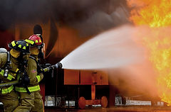
-
Fires are one of the major hazards facing Marquette County, both in forested and urban areas. For more information, please see the Community Wildfire Protection Plan.
-
The Michigan Department of Natural Resources has some tips here on ways to reduce your fire risk.